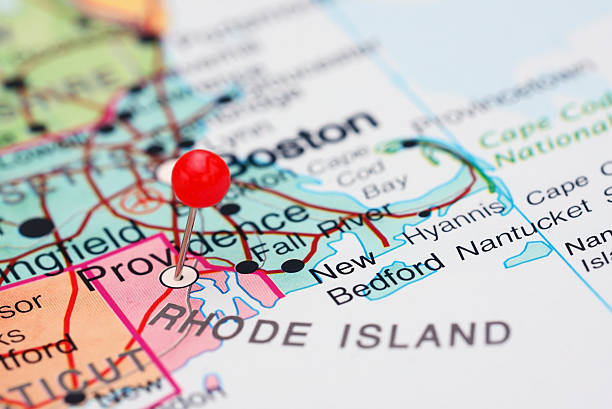
Photo of pinned Providence on a map of USA. May be used as illustration for travelling theme.
Browse 790+ providence rhode island map stock photos and images available, or start a new search to explore more stock photos and images.
Photo of pinned Providence on a map of USA. May be used as illustration for travelling theme.

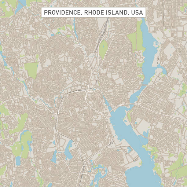
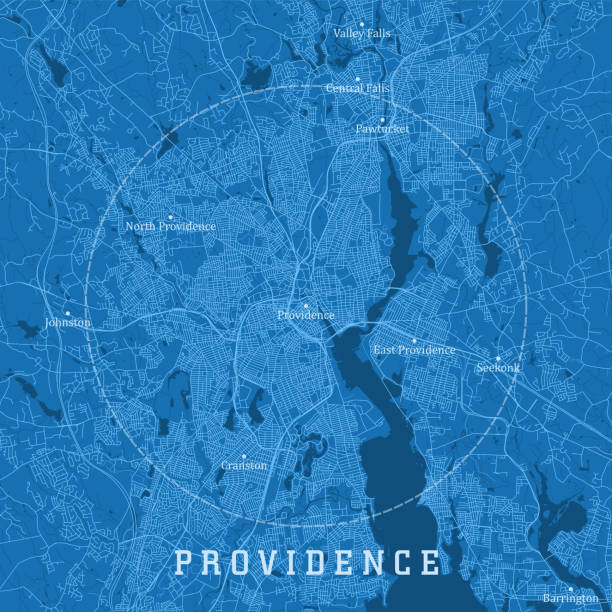
Topographic / Road map of Providence, RI. Map data is public domain via census.gov. All maps are layered and easy to edit. Roads are editable stroke.

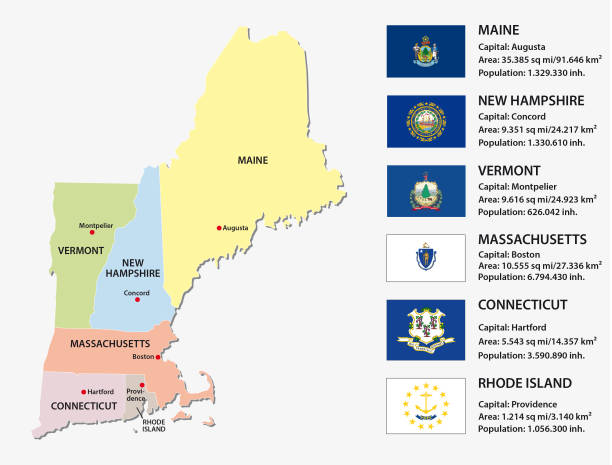
New England region of the United States of America, gray political map. The six states Maine, Vermont, New Hampshire, Massachusetts, Rhode Island and Connecticut with capitals. Illustration. Vector.
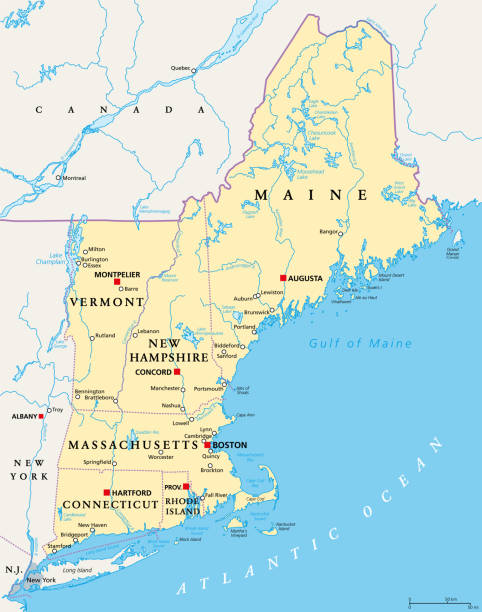
New England region of the United States of America, political map. Maine, Vermont, New Hampshire, Massachusetts, Rhode Island and Connecticut with their Capitals and borders. Illustration. Vector.
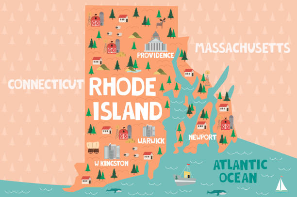
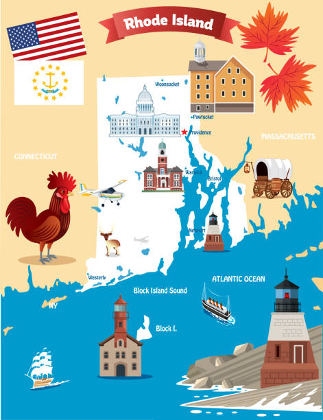
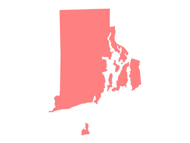
Illustrated map of the state of Rhode Island in United States with cities and landmarks. Editable vector illustration
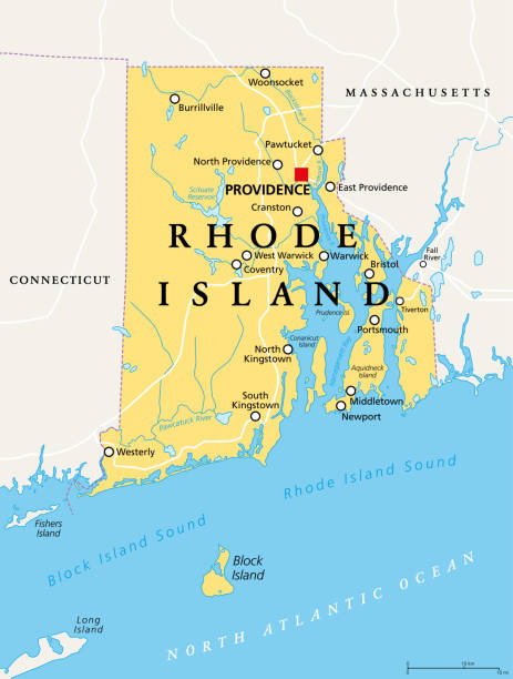
Rhode Island, political map with the capital Providence. State of Rhode Island and Providence Plantations, RI, a state in the New England region of the United States of America. Illustration. Vector.
Vector Illustration of a City Street Map of Providence, Rhode Island, USA. Scale 1:60,000. All source data is in the public domain. U.S. Geological Survey, US Topo Used Layers: USGS The National Map: National Hydrography Dataset (NHD) USGS The National Map: National Transportation Dataset (NTD)
rhode island county and city vector map

Map of Rhode Island in a trendy vintage style. Beautiful retro illustration with old textured paper and light rays in the background (colors used: blue, green, beige and black for the outline). Vector Illustration (EPS10, well layered and grouped). Easy to edit, manipulate, resize or colorize.
Providence RI City Vector Road Map Blue Text. All source data is in the public domain. U.S. Census Bureau Census Tiger. Used Layers: areawater, linearwater, roads.

vector illustration of Rhode Island map

Providence, Rhode Island on 1880's map. Selective focus and Canon EOS 5D Mark II with MP-E 65mm macro lens.

Rhode Island, political map with capital Providence. State of Rhode Island and Providence Plantations, RI, in the New England region of United States of America. Gray illustration, over white. Vector.

New England, a region of the United States, political map. Maine, Vermont, New Hampshire, Massachusetts, Rhode Island and Connecticut with Capitals. Bordered by the Mid-Atlantic region and by Canada.

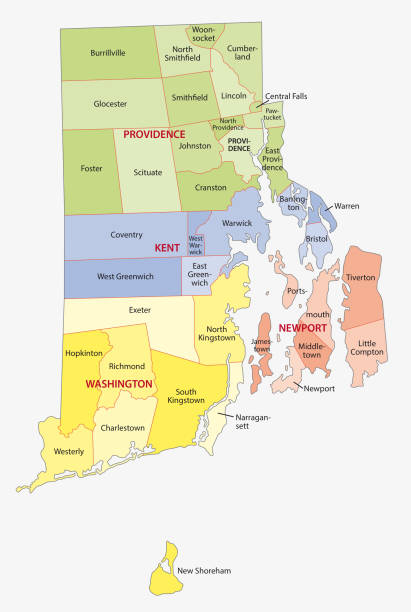
rhode island administrative and political vector map

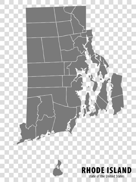
Detailed vector map of the US State of Rhode Island with administrative divisions. The colors in the .eps-file are ready for print (CMYK). Included files are EPS (v10) and Hi-Res JPG.

Topographic / Road map of Providence, RI. Map data is public domain via census.gov. All maps are layered and easy to edit. Roads are editable stroke.

Highway map of the state of Rhode Island with Interstates and US Routes. It also has lines for state routes and many cities on it as well. All cities are the County Seats and the Capitol.

Vintage map of the state of Rhode Island, USA. - See lightbox for more
New england states vector map with flags
Red Thumbtack Over Rhode Island State USA Map. 3D rendering

Topographic / Road map of Providence, RI. Map data is public domain via census.gov. All maps are layered and easy to edit. Roads are editable stroke.

A close-up/macro photograph of Philadelphia and New York City from a desktop globe. Adobe RGB color profile.

RI Providence East Providence Vector Road Map. All source data is in the public domain. U.S. Census Bureau Census Tiger. Used Layers: areawater, linearwater, roads, rails, cousub, pointlm, uac10.

Vector Illustration of a Road Map of Rhode Island State, USA. All source data is in the public domain. U.S. Geological Survey, US Topo Used Layers: USGS The National Map: National Hydrography Dataset (NHD) USGS The National Map: National Transportation Dataset (NTD)

Map from the Complete Handy Atlas of the World - 1898
vector illustration of Rhode Island map
vector illustration of Rhode Island map

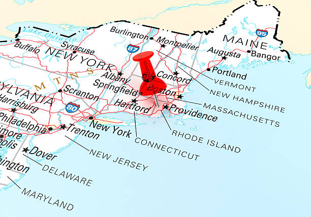
Map of New York, New Jersey, Providence, Connecticut, and Massachusetts States in USA. Detail from the World Map.

New England region of the United States of America, gray political map. Maine, Vermont, New Hampshire, Massachusetts, Rhode Island and Connecticut with capitals and borders. Illustration. Vector.

White map of Rhode Island isolated on a gray background with a long shadow effect and in a flat design style. Vector Illustration (EPS10, well layered and grouped). Easy to edit, manipulate, resize or colorize.

Warren's Common School Geography 1877

A vintage-style map of Rhode Island with freeways, highways and major cities. Shoreline, lakes and rivers are very detailed. Includes an EPS and JPG of the map without roads and cities. Texture, compass, cities, etc. are on separate layers for easy removal or changes.

White map of Rhode Island isolated on a trendy color, a bright red background and with a dropshadow. Vector Illustration (EPS file, well layered and grouped). Easy to edit, manipulate, resize or colorize. Vector and Jpeg file of different sizes.

19th century map of Rhode island and Connecticut. Published in New Dollar Atlas of the United States and Dominion of Canada. (Rand McNally & Co's, Chicago, 1884).

Map of Nassau capital of the Bahamas on the island New Providence.

Map of Rhode Island for your own design. With space for your text and your background. Four maps included in the bundle: - One black map on a white background. - One blank map on a black background. - One white map with shadow on a blank background (for easy change background or texture). - One blank map with only a thin black outline (in a line art style). The layers are named to facilitate your customization. Vector Illustration (EPS10, well layered and grouped). Easy to edit, manipulate, resize or colorize. Please do not hesitate to contact me if you have any questions, or need to customise the illustration. http://www.istockphoto.com/portfolio/bgblue

Map of Rhode Island in a trendy vintage style. Beautiful retro illustration with old textured paper and a black long shadow (colors used: blue, green, beige and black). Vector Illustration (EPS10, well layered and grouped). Easy to edit, manipulate, resize or colorize.

Illuminati eyes with mason pyramids. Triangle providence symbols with all seeing eye of God and glory light sketches. Vector engraving tattoo, occult, esoteric religion and alchemy magic amulets

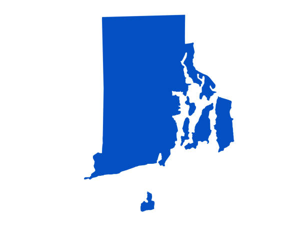
Rhode island map shape, united states of america. Flat concept symbol vector illustration .

New England region detailed editable map with cities and towns, geographic sites, roads, railways, interstates and U.S. highways. Vector EPS-10 file, trending color scheme

Vector Rhode Island travel sticker or luggage label.

Map of Rhode Island made with round blue dots on a blank background. Original mosaic illustration. Vector Illustration (EPS10, well layered and grouped). Easy to edit, manipulate, resize or colorize. Please do not hesitate to contact me if you have any questions, or need to customise the illustration. http://www.istockphoto.com/portfolio/bgblue
© 2025 iStockphoto LP. The iStock design is a trademark of iStockphoto LP. Browse millions of high-quality stock photos, illustrations, and videos.
Do Not Sell or Share