Wide angle of Caracas skyline, Venezuela
Browse 5,500+ venezuela architecture stock photos and images available, or search for caracas to find more great stock photos and pictures.

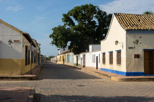
Exterior view of colourful houses in historic centre of Ciudad Bolivar, Bolivar State, Venezuela.
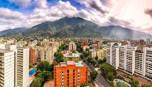
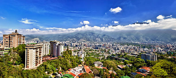
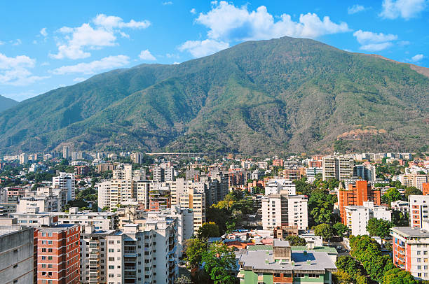
Eastern Caracas panoramic city view at Chacao Municipality. Image taken at mid afternoon with Avila mountain in the background.Cerro El Avila en el Municipio Chacao.

San Diego de Alcalá or Fuerte Campo Elías Castle, Delta Amacuro, Venezuela
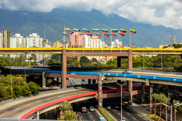
Multi level highway in center of Caracas capital Venezuela with national flags at day
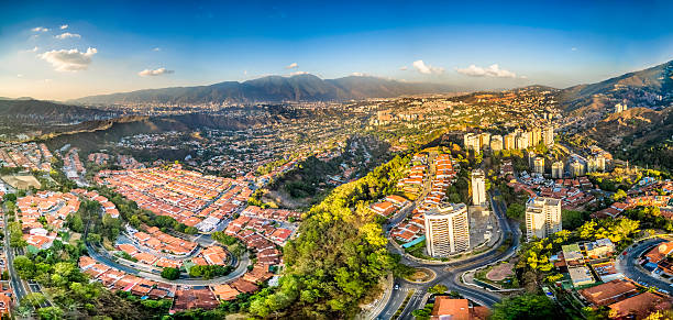
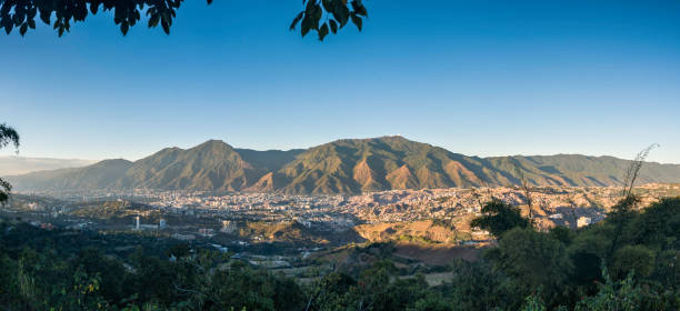
Panoramic image of eastern Caracas city aerial view at late afternoon. Venezuela. Showing El Avila mountain also known as El Avila National Park (Guaraira Repano). Santiago de Leon de Caracas, is the capital city of Venezuela and center of the Greater Caracas Area. It is located in the northern part of the country, following the contours of the narrow Caracas Valley and the "Cordillera de la Costa". The valley is close to the Caribbean Sea, separated from the coast by a steep 2,200 m (7,200 ft) high mountain range, Cerro El Avila. To the south there are many more hills and mountains with residential constructions. Caracas is divided into five municipalities: Libertador, Chacao, Baruta, Sucre, and El Hatillo. Libertador holds many of the government buildings and is the Capital District (Distrito Capital). The Metropolitan Region of Caracas has an estimated population of 5,250.000.
Panoramic image of eastern Caracas city aerial view at late afternoon. Venezuela. Showing El Avila mountain.
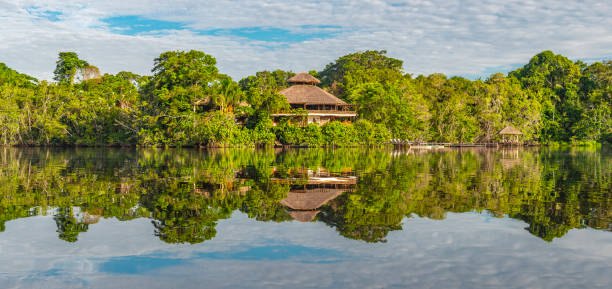
Traditional architecture of an Amazon rainforest lodge in panoramic composition, Yasuni national park, Ecuador. The tributaries of the Amazon river comprise the countries of Suriname, Guyana, French Guyana, Venezuela, Colombia, Ecuador, Peru, Bolivia and Brazil.
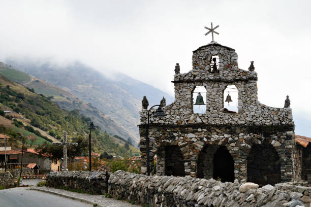
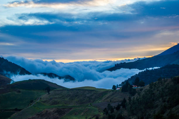
Stone Churh, San Rafael de Mucuchies, Merida state, Venezuela. Hand made small church which is an important landmark. Mucuchies is the main town in El Paramo Andino, in Merida state, Venezuela. Located about 2400 meters above sea level. It is a farmer´s town with large plantations of potatoes, carrots and garlic. It is characterized by a cold climate, colorful mountains and, due to its agricultural activity, stone boundaries, small waterfalls, wild flowers and frailejons, shows incredible and beautiful landscapes.
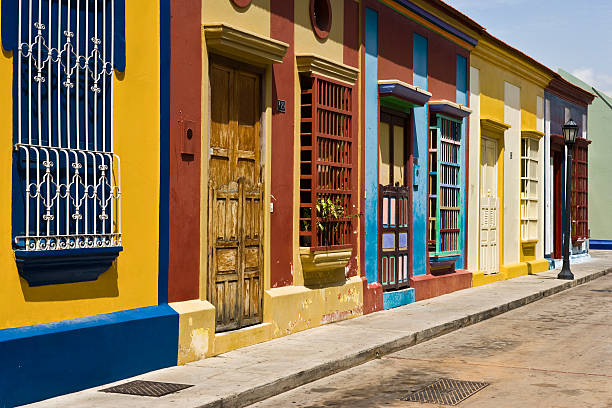
Carabobo street with colorful houses, Maracaibo, Zulia State, Venezuela
Valle de Caracas, capital de Venezuela, al atardecer.
Caracas panoramic on a sunny day, you can see the Avila Mountain and the city at its foot as well as the surrounding hills
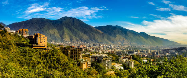
A view of the Avila mountain range in Caracas - Venezuela with the city of Caracas in the foreground. The Avila mountains are considered an extension of the Andes, being its last segment of its northern extreme.
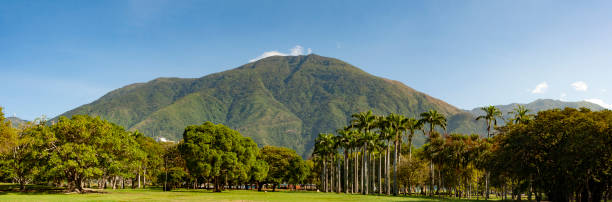
Panorama view of The El Ávila National Park (or Waraira Repano, from an indigenous name for the area), in Caracas, Venezuelan Capital.

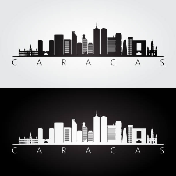
Caracas Venezuela City Skyline with Color Buildings Isolated on White. Vector Illustration. Business Travel and Tourism Concept with Historic Buildings. Caracas Cityscape with Landmarks.

Aerial view of the oil industry in Cabimas, near the Maracaibo lake, where an enormous deposit of oil discovered in the 1910's have made Venezuela one of the world's major oil exporters.
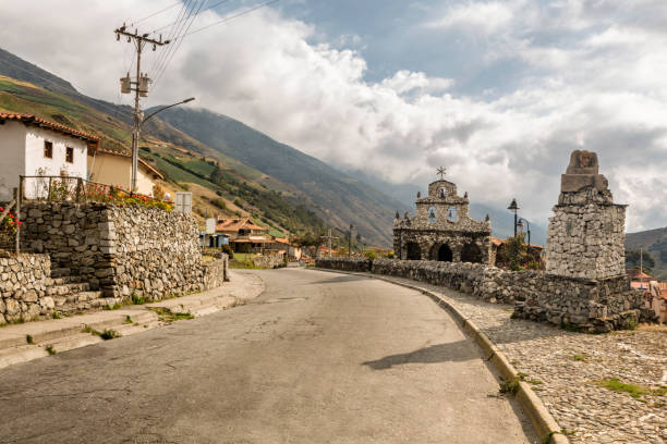
Stone Churh, San Rafael de Mucuchies, Merida state, Venezuela. Hand made small church which is an important landmark. Mucuchies is the main town in El Paramo Andino, in Merida state, Venezuela. Located about 2400 meters above sea level. It is a farmer´s town with large plantations of potatoes, carrots and garlic. It is characterized by a cold climate, colorful mountains and, due to its agricultural activity, stone boundaries, small waterfalls, wild flowers and frailejons, shows incredible and beautiful landscapes.
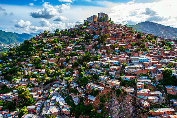
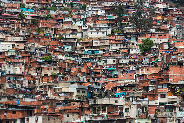
Slum zone in Caracas city, Venezuela capital

"Los Palmeros de Chacao" is a Venezuelan tradition dating back to the year 1770. On Wednesday before Easter, they climb to the Avila hill to select and harvest a number of palm leaves. On Saturday morning they descend to the city until the Church of San José de Chacao. Making several stops and in each one they are received by some traditional party of the country. When they arrive at the Church, the priest makes the blessing of the palms which will be delivered the following day (Palm Sunday) at the corresponding Masses, thus beginning Holy Week.

South America, Venezuela, Coro is one of the prettiest colonial cities in Venezuela. Cityscape - old town - colonial architecture

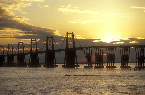
Rafael Urdaneta Bridge (also called Maracaibo Bridge) is located at the Tablazo Strait outlet of Lake Maracaibo, in western Venezuela. The bridge connects Maracaibo with much of the rest of the country.

View from above of a coastline, with beach, blue sky with clouds, mountains, hotels, boats, city and streets in Juan Griego

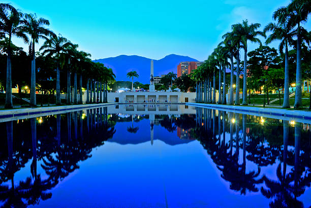
Caracas, Venezuela - December 31, 2018. The Soto Sphere (La Esfera de Soto) is kinetic art sculpture by the Venezuelan plastic artist Jesús Soto, inaugurated in 1997. It is part of a government program called Un Cariño para mi Ciudad. It is located on the southern slope of the Santa Cecilia distributor of the Francisco Fajardo highway. The Soto Sphere also known as The Caracas Sphere is one of the cultural icons of the capital of Venezuela.

Cityscape of Colorful. Colorful town of La Guaira, near Caracas, Venezuela. Colorful buildings in a narrow street.

pov photo of a colonial street in landscape format, with a church at the end
![Light at the end of tunnel? Social Issues: Architectural Chaos in poverty zones, Caracas, Venezuela.
Other Links:
[url=file_closeup.php?id=5291102][img]file_thumbview_approve.php?size=1&id=5291102[/img][/url] [url=file_closeup.php?id=5290975][img]file_thumbview_approve.php?size=1&id=5290975[/img][/url] [url=file_closeup.php?id=5290974][img]file_thumbview_approve.php?size=1&id=5290974[/img][/url] [url=file_closeup.php?id=5291132][img]file_thumbview_approve.php?size=1&id=5291132[/img][/url] [url=file_closeup.php?id=5323995][img]file_thumbview_approve.php?size=1&id=5323995[/img][/url]
Check out more of my [u][b][url=file_search.php?text=social&issues,%20shanty,&action=file&filetypeID=1&username=apomares]Social Issues[/url][/b][/u] images venezuela architecture stock pictures, royalty-free photos & images](https://media.istockphoto.com/id/108195369/photo/light-at-the-end-of-tunnel.jpg?s=612x612&w=0&k=20&c=4T_TvvnVxdkXYesfJ62poSrXVodjaIow3C48KwpXFFs=)
Social Issues: Architectural Chaos in poverty zones, Caracas, Venezuela. Other Links: [url=file_closeup.php?id=5291102][img]file_thumbview_approve.php?size=1&id=5291102[/img][/url] [url=file_closeup.php?id=5290975][img]file_thumbview_approve.php?size=1&id=5290975[/img][/url] [url=file_closeup.php?id=5290974][img]file_thumbview_approve.php?size=1&id=5290974[/img][/url] [url=file_closeup.php?id=5291132][img]file_thumbview_approve.php?size=1&id=5291132[/img][/url] [url=file_closeup.php?id=5323995][img]file_thumbview_approve.php?size=1&id=5323995[/img][/url] Check out more of my [u][b][url=file_search.php?text=social&issues,%20shanty,&action=file&filetypeID=1&username=apomares]Social Issues[/url][/b][/u] images
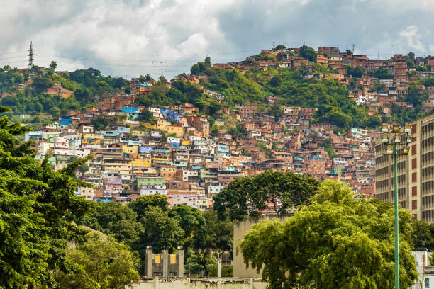
Urban residential buildings on hill in Caracas Venezuela capital at day
Old architecture zone in Caracas, Venezuela.
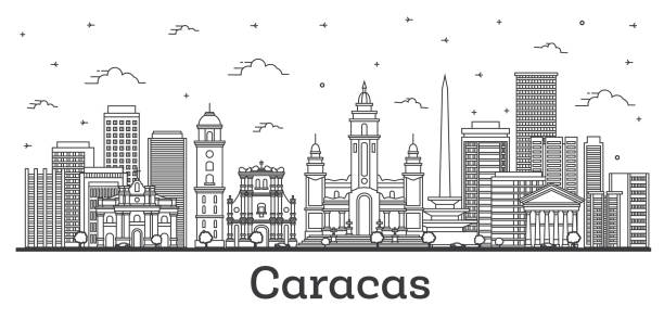
Outline Caracas Venezuela City Skyline with Modern and Historic Buildings Isolated on White. Vector Illustration. Caracas Cityscape with Landmarks.
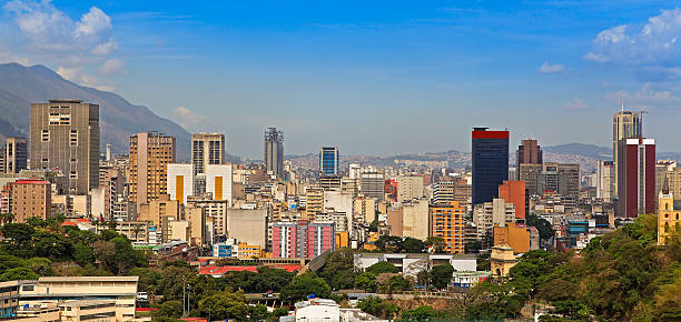
Skyline of downtown Caracas, capital and largest city of Venezuela

Vector illustration (eps)
Spanish style colonial houses in the street, Carora, Lara State, Venezuela

Basilica of Our Lady of Chiquinquira, in the city of Maracaibo, Zulia state, Venezuela,
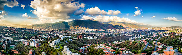
Panoramic image of eastern Caracas city aerial view at late afternoon. Venezuela. Showing El Avila mountain also known as El Avila National Park (Guaraira Repano). Santiago de Leon de Caracas, is the capital city of Venezuela and center of the Greater Caracas Area. It is located in the northern part of the country, following the contours of the narrow Caracas Valley and the "Cordillera de la Costa". The valley is close to the Caribbean Sea, separated from the coast by a steep 2,200 m (7,200 ft) high mountain range, Cerro El Avila. To the south there are many more hills and mountains with residential constructions. Caracas is divided into five municipalities: Libertador, Chacao, Baruta, Sucre, and El Hatillo. Libertador holds many of the government buildings and is the Capital District (Distrito Capital). The Metropolitan Region of Caracas has an estimated population of 5,250.000.

City skyline set. South America. Vector silhouette background illustration.

Small or compact modern kitchen with appliances. Contemporary style. Sparse design. White cabinets. Example of design for small architectural spaces. Front view, horizontal composition. Kitchen background.
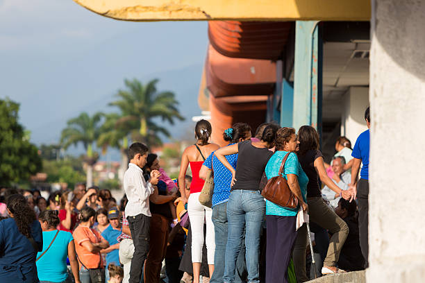
Merida, Venezuela - April 29, 2015: Group of people waiting in line at a public supermarket doors in Merida. With significant inflation, rationing is required in some places in Venezuela in 2015.

The General Rafael Urdaneta Bridge is made of reinforced and prestressed concrete, and the cable-stayed bridge spans 8,678 meters (5.4 miles) from shore to shore.

At Maracaibo city Zulia State Venezuela

Enchanting colonial charm visible in the streets and buildings of Puerto Cabello, Venezuela, with colorful details and historical significance.
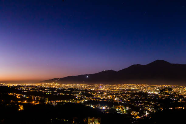
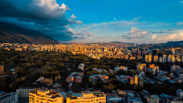
Caracas sunset with the Avila as a backdrop

Barranquilla is an industrial port city and municipality located in northern Colombia, near the Caribbean Sea. The capital of the Atlántico Department, it is the largest industrial city and port in the Colombian Caribbean region with a population of 1,148,506 as of 2005, which makes it Colombia's fourth most populous city after Bogotá, Medellín and Cali.

Panoramic view of Caracas City at sunset from Cota Mil. Venezuela

Panoramic image of eastern Caracas city aerial view at late afternoon. Venezuela. Showing El Avila mountain.

Caracas Skyline with Gray Buildings and Blue Sky. Vector Illustration. Business Travel and Tourism Concept with Historic Buildings. Image for Presentation Banner Placard and Web Site.
© 2025 iStockphoto LP. The iStock design is a trademark of iStockphoto LP. Browse millions of high-quality stock photos, illustrations, and videos.
Do Not Sell or Share