vector illustration of American Samoa map
Browse 1,000+ american samoa map stock photos and images available, or search for american samoa map vector to find more great stock photos and pictures.
vector illustration of American Samoa map
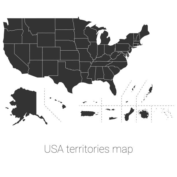
Vector illustration of the USA territories map

Outline Political US Map with titles of the states. All USA regions are separated and named in a layer panel.

Samoan Islands political map with English labeling. Samoa and American Samoa. Archipelago in the central Pacific Ocean, part of Polynesia and Oceania. Gray illustration on white background. Vector.

Vector illustration of a map of the USA territories and associated states
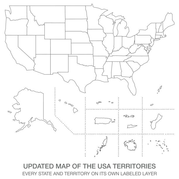
Vector illustration of an updated version of the map of the USA Territories

Vector illustration of the USA territories map

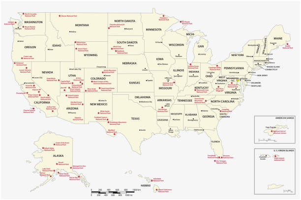
Vector US National Park https://maps.lib.utexas.edu/maps/united_states/us_general_reference_map-2003.pdf

EPS 10 Vector illustration of American Samoa green shiny map. Used transparency.

vector illustration of American Samoa map

Samoan Islands political map with Samoa, formerly known as Western Samoa and American Samoa and their capitals Apia and Pago Pago. English labeling and scaling. Illustration.

American Samoa 3D Map on White Background, Useful for Politics, Elections, Travel, News and Sports Events

Map of American Samoa sketched and isolated on a blank background. The map is gray with a black outline. Vector Illustration (EPS file, well layered and grouped). Easy to edit, manipulate, resize or colorize. Vector and Jpeg file of different sizes.

3d vector illustrated colorful touristic map of American Samoa islands with cities and villages

Map of American Samoa for your own design. Three maps with editable stroke included in the bundle: - One black map on a white background. - One line map with only a thin black outline in a line art style (you can adjust the stroke weight as you want). - One map on a blank transparent background (for change background or texture). The layers are named to facilitate your customization. Vector Illustration (EPS file, well layered and grouped). Easy to edit, manipulate, resize or colorize. Vector and Jpeg file of different sizes.

3D black map of American Samoa isolated on a blank background, with a dropshadow. Vector Illustration (EPS file, well layered and grouped). Easy to edit, manipulate, resize or colorize. Vector and Jpeg file of different sizes.
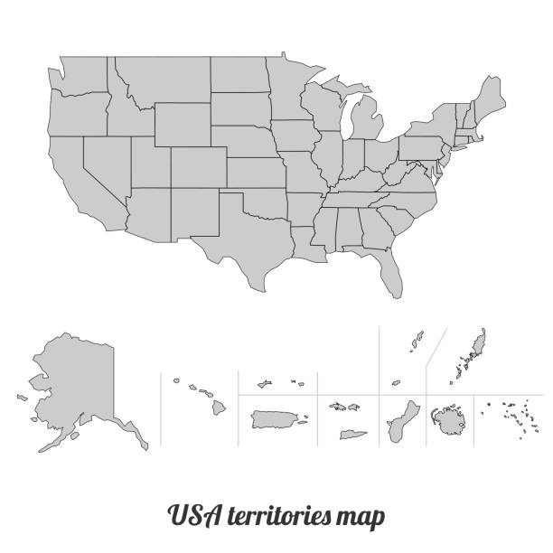
Vector illustration of the USA territories map
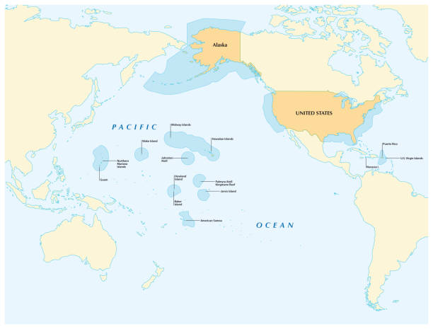
insular area vector map of the United States.

vector illustration of American Samoa maps

Black map collection, black contour maps of World. Map collection Part 1.

American Samoa political map with capital Pago Pago is an United States territory and part of Samoan Islands in South Pacific Ocean. English labeling and scaling. Illustration.

Vector illustration of an updated version of the map of the USA Territories
Map of American Samoa isolated on white background. Includes 9 buttons with a flat design style for your design, in different colors (red, orange, yellow, green, blue, purple, gray, black, white, line art), each icon is separated on its own layer. Vector Illustration (EPS10, well layered and grouped). Easy to edit, manipulate, resize or colorize.

vector illustration of American Samoa map

vector illustration of American Samoa map

Highly detailed physical map of Samoa and American Samoa in vector format,with all the relief forms,regions and big cities.

GRAY CMYK color detailed flat stencil map of the USA territory of AMERICAN SAMOA on transparent background

Niue, political map. Self governing island state, situated in the South Pacific Ocean, part of Polynesia, with capital Alofi. The island is subdivided into 14 municipalities and electoral districts.

USA National Park Map https://maps.lib.utexas.edu/maps/united_states/us_general_reference_map-2003.pdf

Vector illustration of the USA territories map
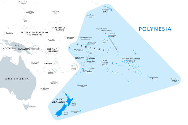
Polynesia, subregion of Oceania, political map. A region, made up of more than 1000 islands scattered over the central and southern Pacific Ocean. English. Illustration on white background. Vector.

Detailet american samoa vector map with flag

Waving Realistic Vector Flag Set. Oceania Flags Isolated on White Background

Territories of the United States, political map. Subnational administrative divisions. The 50 states, and incorporated, unincorporated, organized, unorganized and territories with Commonwealth status.

Map of Niue cut out on a blank white paper with a blue background. Modern and trendy paper cutout effect. Vector Illustration (EPS file, well layered and grouped). Easy to edit, manipulate, resize or colorize. Vector and Jpeg file of different sizes.

US map silhouette. Map of America and regions. USA frame background

Vector illustration of an updated version of the map of the USA Territories

Vector US National Parkhttps://maps.lib.utexas.edu/maps/united_states/us_general_reference_map-2003.pdf
Map of American Samoa for your own design. Four maps with editable stroke included in the bundle: - One black map on a white background. - One blank map on a black background. - One white map with shadow on a blank background (for easy change background or texture). - One line map with only a thin black outline (in a line art style). The layers are named to facilitate your customization. Vector Illustration (EPS10, well layered and grouped). Easy to edit, manipulate, resize or colorize. Vector and Jpeg file of different sizes.

Map of American Samoa created with a thin black outline and a shadow, isolated on a blank background. Vector Illustration (EPS10, well layered and grouped). Easy to edit, manipulate, resize or colorize. Vector and Jpeg file of different sizes.

Map of American Samoa isolated on a blank background with a black outline and shadow. Vector Illustration (EPS file, well layered and grouped). Easy to edit, manipulate, resize or colorize. Vector and Jpeg file of different sizes.

White map of American Samoa isolated on a blue background with a long shadow effect and in a flat design style. Vector Illustration (EPS10, well layered and grouped). Easy to edit, manipulate, resize or colorize.

New Zealand and southern Polynesia, political map with capitals. Solomon Islands, Vanuatu, Fiji, Tonga, Samoa and New Caledonia. South Pacific Ocean islands. English labeling. Illustration. Vector.

National Parks of America https://maps.lib.utexas.edu/maps/united_states/us_general_reference_map-2003.pdf
A circle of religious symbols. International religions of the world in the signs. Isolated symbol of world cultures on a white background.
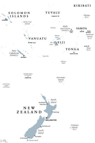
New Zealand and southern Polynesia, gray political map with capitals. Solomon Islands, Vanuatu, Fiji, Tonga, Samoa and New Caledonia. Islands in the South Pacific Ocean. English. Illustration. Vector.

Colored Political US Map with titles of the states. All USA regions are separated and named in a layer panel