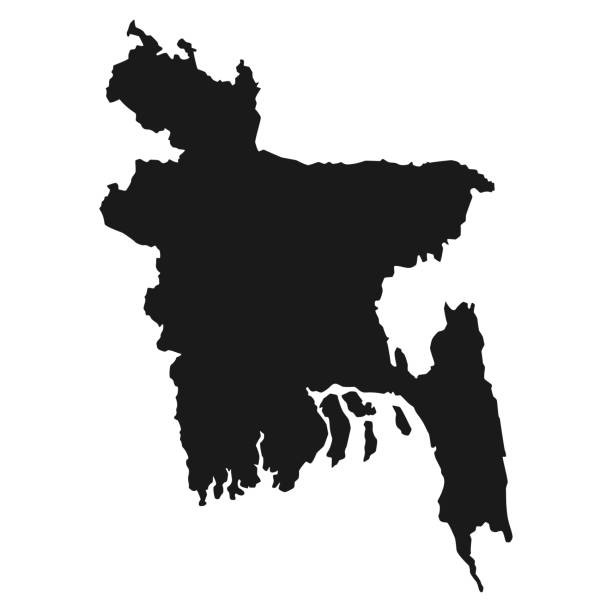
Black Map Of Bangladesh Isolated On White Background, Vector Illustration world geography .
Browse iStock’s library of over 150000 Bangladesh stock photos to find your ideal image. You’ll be able to choose stock imagery of Bangladesh that includes aerial views of Dhaka photos of Bangladesh rice fields and stunning images of the Himalayan foothills. Our royalty-free collection of Bangladesh photos also features traditional Bangladesh dishes like panta ilish as well as images of the Bangladesh national animal the Bengal tiger.
Black Map Of Bangladesh Isolated On White Background, Vector Illustration world geography .

The image shows a group of people at a public event, holding up the national flags of Bangladesh. This scene likely represents a moment of national pride or a significant cultural or political event. The unity and collective identity of the participants are highlighted by the multiple flags being waved. The outdoor urban setting, with overhead cables and trees in the background, adds to the context of the gathering.
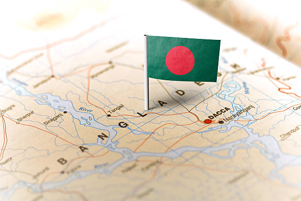
The flag of Bangladesh pinned on the map. Horizontal orientation. Macro photography.

Bangladesh and India flag together realtions textile cloth fabric texture
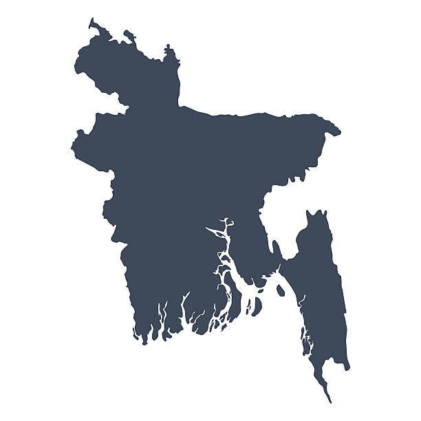
A graphic illustrated vector image showing the outline of the country Bangladesh. The outline of the country is filled with a dark navy blue colour and is on a plain white background. The border of the country is a detailed path.

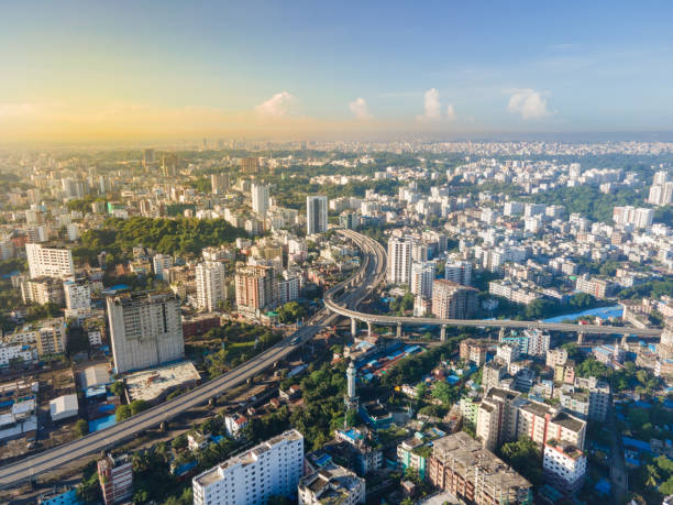
Area of Dhaka, the Capital of Bangladesh

Dhaka is the capital city of Bangladesh, in southern Asia. Set beside the Buriganga River, it’s at the center of national government, trade and culture.
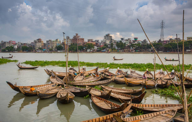
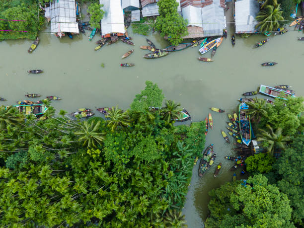
All boats stands here in a circular way for repairing & cleaning. This photo was taken from Kamrangirchar area near Dhaka city.
The virus that causes the illness COVID-19 has hit 169 countries, infecting over 400,000 people and killing more than 18,000 until early Wednesday. Bangladesh has 39 known cases with four confirmed deaths. Considering that the effects of an outbreak in the densely populated country will be catastrophic, the government had earlier imposed restrictions on gatherings and closed educational institutions.
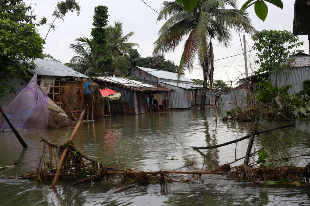
Due to heavy rains, the lower part of Sylhet has turned into a flood. Houses submerged in flood waters. Photo taken from Sunamganj, Sylhet Division in Bangladesh on 18 June 2022.

The lower part of Sylhet city has been flooded. Acute shortage of clean drinking water. People from the affected areas are collecting water from far away. The photo taken from Sylhet in Bangladesh on 17 May 2022.
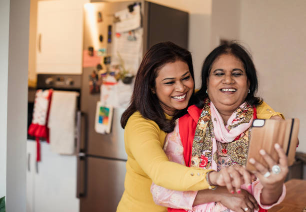
Two women take a selfie in the kitchen. The senior woman is wearing a duppatta.
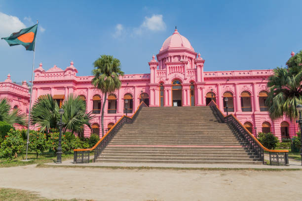
Ahsan Manzil, former residential palace of the Nawab of Dhaka, Bangladesh

The traffic of Dhaka is one of the worst in the world, according to the official statistics, every Dhaka resident averagely spend 3.5 hours on street each day.

Sirajganj, Bangladesh - February 3, 2021: Fishermen are seen floating on top of algae as they search for potential catch in the sharp green waters of a river. The Sirajganj spot in Bangladesh is a popular place for locals to swim and bathe even in the cold water. Algae make the water cloudy and climate change causes the river to become polluted and dry out.
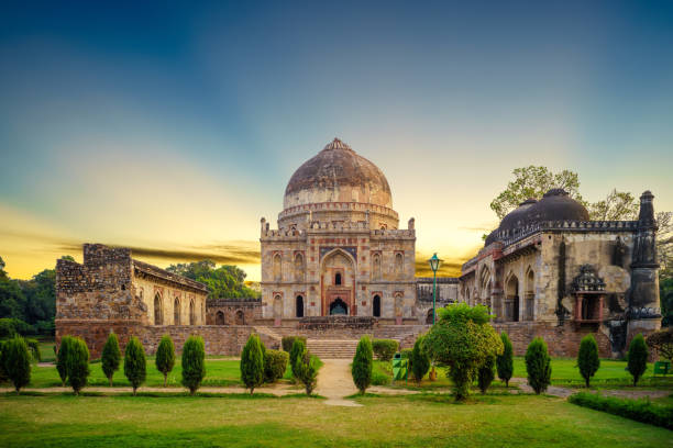
Lodhi Gardens is a city park situated in New Delhi, India. Spread over 90 acres

National flag of Bangladesh waving in the wind on a clear day. Dark green banner with a red disc or sun on top. 3d illustration render. Fluttering fabric
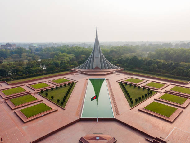
SAVAR, DHAKA, BANGLADESH – February 23, 2022: Bangladesh National Martyrs' Memorial. Bangladesh Independence Day Background. Victory Day Background. 26th March Independence Day of Bangladesh. 16th December Victory Day of Bangladesh.

August 9, 2023, Chittagong, Bangladesh: Pedestrians walk through flooded roads in Satkania Upazila of South Chittagong, Bangladesh in chest and waist level water. The life of the people of Satkania Upazila of Chittagong has been severely disrupted due to continuous rains for five consecutive days, hill slopes coming down from the upstream, the water level of Shanka river has increased. About 242 km southeast of Bangladesh's seaport city of Chittagong, low-lying areas were inundated and road traffic disrupted with the highest rainfall.

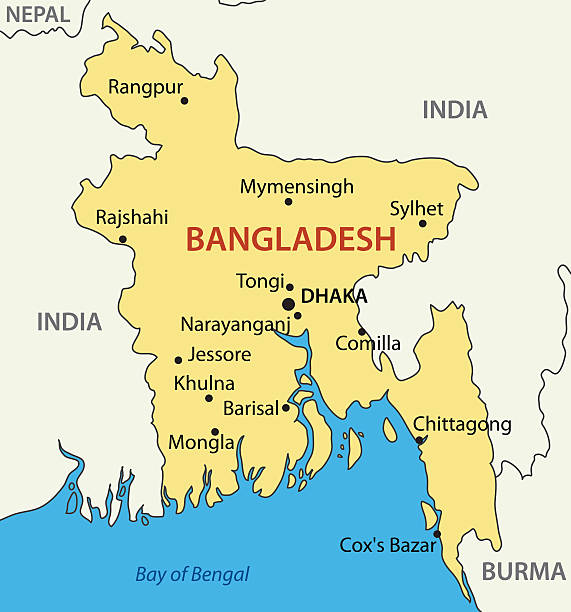
Bangladesh political map with capital Dhaka, national borders, important cities, rivers and lakes. English labeling and scaling. Illustration.

T-shirt made in Bangladesh. Customer looking at the origin and import country of a cheap fashion product in clothes store or shop.

Vector illustration of the flag of Bangladesh. Horizontal format. Flag file is in official RGB color space for accurate representation on digital and rgb based print media. Fully editable and scalable vector eps 10 format and high resolution jpg.
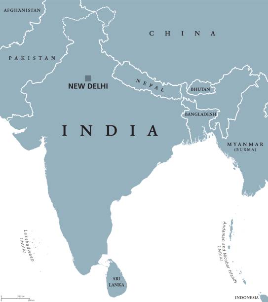
India political map with capital New Delhi, national borders and neighbor countries. Republic and subcontinent in South Asia. Gray illustration, English labeling. Isolated on white background. Vector.
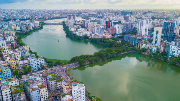
Hatirjheel (meaning Elephant Lake) is a lakefront in Dhaka, Bangladesh that has been transformed into a transportation medium for minimizing traffic congestion. The area was constructed under Bangladesh Army and the Special Works Organization. It is now a popular recreational spot for residents of Dhaka and is currently undergoing renovation.
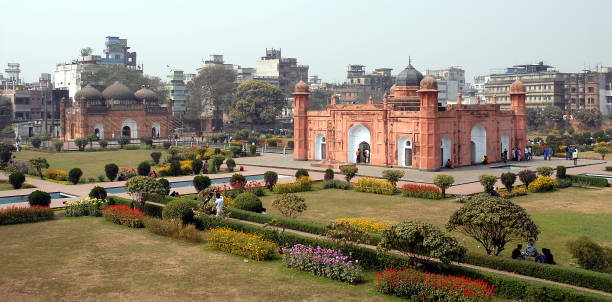
Lalbagh Fort in Dhaka, Bangladesh. This is the tomb of Bibi Pari in the grounds of Lalbagh Fort. To the left with three domes is Lalbagh Fort Mosque.

National flag of Bangladesh with the dome of Ahsan Manzil palace in the background.
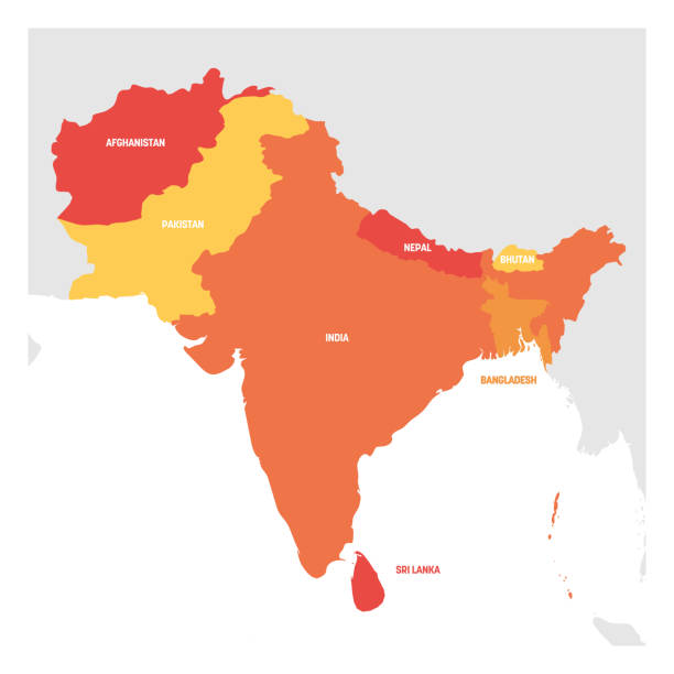
South Asia Region. Map of countries in southern Asia. Vector illustration.

Flag of Bangladesh against a blue skies with a few clouds.

Grunge map of Bangladesh with its flag printed within its border on an old paper.

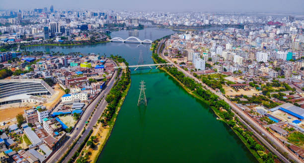
A stunning aerial panoramic view of the Dhaka cityscape skyline during sunset. The metropole commercial areas and modern skyscrapers are beautifully illuminated against a cloudy sky. Perfect for urban-themed projects

Flag of Bangladesh vector in official correctly
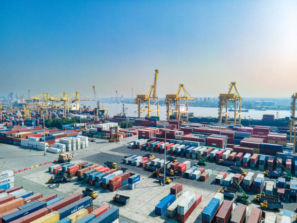
Commercial shipping containers on the port's ground waiting to be shipped at Port city Chittagong, Bangladesh.
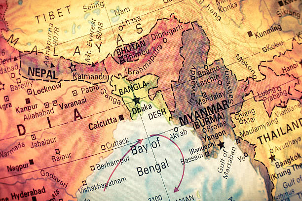
Vintage Map Myanmar,Bangladesh, Close-up macro image of South East Asia map . Selective focus on Bangladesh
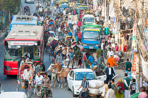
"Dhaka, Bangladesh - January 26, 2013: People fighting their way in a busy street in old Dhaka, Bangladesh."

A boy walks through a street with his grandfather. They are both wearing a kurta/salwar kameez.

Gowainghat, Bangladesh - November 06, 2019: Poor woman standing in front of her broken house fighting to survive with a little boy child on her lap. Happy mother and child bonding.
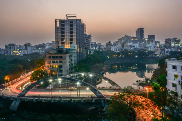
Photo of the under-construction building and surrounding water bodies and traffic flows
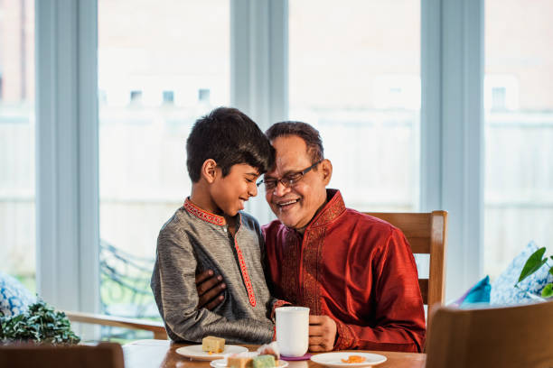
A boy wearing a kurta sits and laughs at a dining table with his grandfather who is also wearing a kurta.

Lakhs of Muslims have gathered in the second phase of Vishwa Ijtema. They will stay there for three days by pulling colored cloth over it. Such a picture looks charming. The photo was taken from Tongi in Gazipur district of Bangladesh.

Rangpur, Bangladesh - September 18, 2017 Group of woman walking together around a river bank area

Photo of recently constructed high rise building around the Bananai residential area, Dhaka, Bangladesh
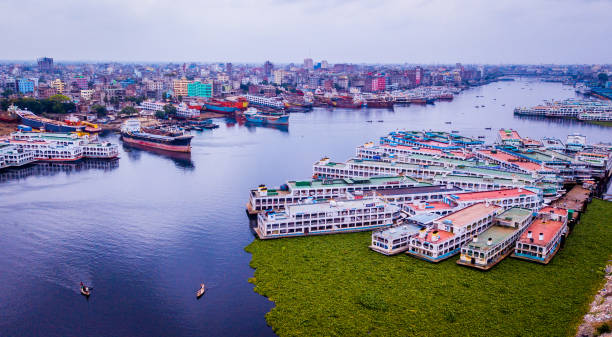
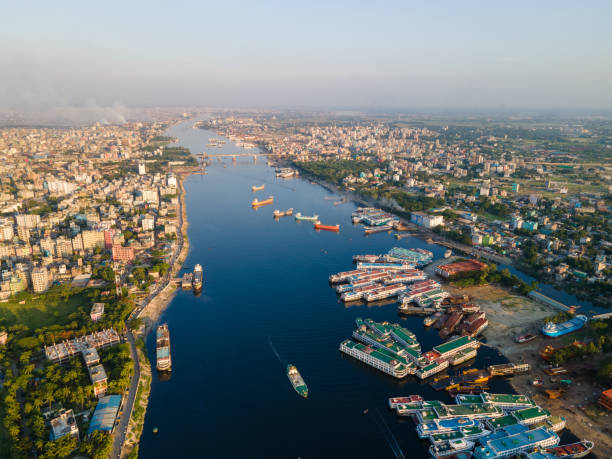
The Port of Dhaka is a major river port on the Buriganga River in Dhaka, the capital and largest city of Bangladesh. The port is located in the southern part of the city. It is Bangladesh's busiest port in terms of passenger traffic. The port has services to most of the districts of Bangladesh.

Silhouette Skyline panorama of city of Dhaka, Bangladesh - vector illustration

A mid adult woman hugs a senior man. They are both wearing a kurta.

Rawalpindi, commonly known as Pindi, is adjacent to Pakistan's capital of Islamabad, and the two are jointly known as the twin cities.